


1931 Map Showing Isle of Pleasure
the Vintage Map Shop, Inc.
Regular price $45.00
Unit price per
By: H.J. (Heinie) Lawrence
Date: 1931 (dated) Houston, Texas
Original Size: 20 x 17.5 inches
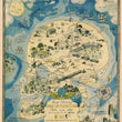
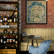
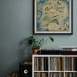
This is a fine print reproduction of a humorous Prohibition era pictorial map that illustrates the many vices that lay within the "Isle of Pleasure." The isle itself is in the shape of a human skull and is aptly names the "State of Inebriation," which is surrounded by the "Whiskey Strait," "Gulp Stream," and the "Prohibition Sea."
The Prohibition Era of the United States ran from 1920 - 1933, in which a nationwide constitutional ban on the production, importation, transportation, and sale of alcoholic beverages, led to many unforeseen (if only by legislators) consequences including the distinct rise of organized crime across America. Gangs of all ethnic background and size played a role in one way or another in the smuggling, distribution, and sale of alcohol.
Legal or not, Americans from coast to coast, of every economic class, and ethnic background wanted to drink and one way or another, they would find a way to do so. This map captures much of the 1920's lingo, drinks, speakeasies, and types of alcohol smuggled in and sold in a creative, geographic manner. This map is ideal for anyone with a bar or interest in prohibition and the roaring 20's.
Inventory #81037
About Our Prints
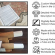
Our prints are fine art reproductions created from original antique maps and vintage posters in our collection, dating back to over 500 years. Each image is professionally scanned, in some cases digitally restored, and carefully printed to preserve the detail, tone, and character of the original work.
- Printed from original maps and prints in our collection
- High-resolution scans for exceptional clarity and detail
- Produced on premium archival paper for long-lasting quality
- Rich color and sharp definition suitable for framing
- Includes a 0.25 inch margin for trimming or matting
- Made to order and securely packaged for safe delivery
Returns and Exchanges
Our prints are made to order, so returns and exchanges are handled within a simple 14-day window. If you need to return or exchange a print, we ask that it be sent back in its original, undamaged condition.
- Returns accepted within 14 days of delivery
- 25% restocking fee on non-damaged returns
- Buyer pays return shipping
- Refunds issued to the original payment method
- Size exchanges available, with shipping and applicable fees paid by the buyer