


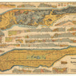

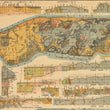
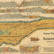
1898 Geologic Map and Sections of Manhattan Island State of New York
the Vintage Map Shop, Inc.
Regular price $45.00
Unit price per
By: Leonard F. Graether. Arch and C.E.
Date of Original: 1898 (dated ) New York, NY
Original Size: 19.25 x 27.75 inches ( 49 x 70.5 cm)
This is a fine print reproduction of an extremely rare geologic map of Manhattan. The map was published within "Atlas of the illustrated building laws of the principal cities of the United States... Vol I Building laws of New York in force in 1898." of which there are only nine recorded institutional examples, some of which did not retain the map.
The map was made primarily for the use of city planners and architecture firms at the turn of the century. Coincidentally, this was also a time of great technological advancement in building as steel was increasingly used to construct the skeleton of taller buildings that had recently taken on the nickname "skyscrapers."
Over a twenty year period from 1890 to 1910 buildings reaching new heights of 40+ stories were being erected at a very high rate. The "Tower Building," known as the first skyscraper of New York City opened in 1901, just two years after the publication of this map. Any initial planning of the Tower Building or any other new project in Manhattan during this time would have required the consultation of the publication from which the map was included and most certainly the map itself.
This incredibly detailed map is a nice continuation of earlier works, such as Colton's Topographical Map (of New York) completed in 1836 and Viele's Sanitary and Topographical Map (of New York) of 1865. What Graether's map adds to the previously mentioned works is a significant amount of additional information pertaining to the geology of Manhattan Island. Such information would be of utmost importance for the many new architectural endeavors of the era.
The map features two large depictions of Manhattan, one focused on the city layout noting locations of borings (a cylindrical sample of earth strata) and wells, and the other, a topographical and geologic map of the natural surface layer of the island. Surrounding these maps are twenty cross sections that illustrate grade variation. layers of strata, and the datum line taken from mean water levels of the North, East, and Harlem Rivers. The end result is a striking visualization of Manhattan that entices closer examination into the geologic under-makings of what is now the central metropolis of America's largest city.
Inventory #11491
About Our Prints
Our prints are fine art reproductions created from original antique maps and vintage posters in our collection, dating back to over 500 years. Each image is professionally scanned, in some cases digitally restored, and carefully printed to preserve the detail, tone, and character of the original work.
- Printed from original maps and prints in our collection
- High-resolution scans for exceptional clarity and detail
- Produced on premium archival paper for long-lasting quality
- Rich color and sharp definition suitable for framing
- Includes a 0.25 inch margin for trimming or matting
- Made to order and securely packaged for safe delivery
Returns and Exchanges
Our prints are made to order, so returns and exchanges are handled within a simple 14-day window. If you need to return or exchange a print, we ask that it be sent back in its original, undamaged condition.
- Returns accepted within 14 days of delivery
- 25% restocking fee on non-damaged returns
- Buyer pays return shipping
- Refunds issued to the original payment method
- Size exchanges available, with shipping and applicable fees paid by the buyer