


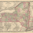
1861 Johnson's New York
The Vintage Map Shop
Regular price $45.00
Unit price per
By: Johnson and Browning
Date of Original: 1861 (published) New York
Original Size: 17 x 25 inches (43 x 63.5 cm)
This is a fine print reproduction of a map of New York State published by Johnson and Browning out of New York in 1861.
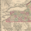
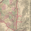
The map is color coded by county with townships also identified and shows railroads, wagon roads, rivers, canals, ports, large towns, and villages of the mid-19th century. Several smaller inset maps include the vicinity of New York, Troy, Albany, Oswego, Buffalo, Rochester, and Syracuse.
Inventory #NA115
About Our Prints
Our prints are fine art reproductions created from original antique maps and vintage posters in our collection, dating back to over 500 years. Each image is professionally scanned, in some cases digitally restored, and carefully printed to preserve the detail, tone, and character of the original work.
- Printed from original maps and prints in our collection
- High-resolution scans for exceptional clarity and detail
- Produced on premium archival paper for long-lasting quality
- Rich color and sharp definition suitable for framing
- Includes a 0.25 inch margin for trimming or matting
- Made to order and securely packaged for safe delivery
Returns and Exchanges
Our prints are made to order, so returns and exchanges are handled within a simple 14-day window. If you need to return or exchange a print, we ask that it be sent back in its original, undamaged condition.
- Returns accepted within 14 days of delivery
- 25% restocking fee on non-damaged returns
- Buyer pays return shipping
- Refunds issued to the original payment method
- Size exchanges available, with shipping and applicable fees paid by the buyer