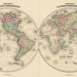


1861 Johnson's Western Hemisphere / Eastern Hemisphere
The Vintage Map Shop
Regular price $45.00
Unit price per
By: Johnson & Browning
Date of Original: 1861 (published) New York
Original Size: 16 x 27 inches (40.5 x 68.5 cm)
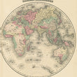
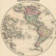
This is a fine example of Johnson's antique world map laid out on a double hemisphere projection. The map features a largely unexplored central Africa with a large lake and a partial Antarctic coastline. Geopolitical boundaries reflect that of the mid-19th century.
The interior of Africa remains largely unexplored which earned it the nickname "the dark continent." The coastline of Antarctica is also incomplete in many areas. In the north is a clear waterway between the Atlantic and Pacific Ocean, commonly referred to as the Northwest Passage, is clearly defined. Geo-political borders are representative of the mid-19th century.
Inventory #WD103


